
Pocket Lake
Well, well, well…It’s August, 2010 and somehow this is my first blog entry. Instead of recounting my reasons for being so busy, I will recount the lake that jarred loose the keyboard.
Pocket Lake
Oh, but before I do that, I want to thank the people at National Geographic. In three days (August 30, 2010), there will be a documentary called Glacier National Park – Wild Spaces that will make its debut on the National Geographic Channel.
Any of you who love the park, have interest in the wild corners of the world, or just want to see me with a farmers tan jumping in cold water should tune in.
It is about the park in general, but for me it marks the first national exposure of the Waterton Glacier Lake Jumping Project. I’m obviously out of my mind excited!!!
So, where was I…?
Oh, Pocket Lake.
So, for the first time in this busiest of summers, my now wife Jess and I went on a backpacking trip. You get three days off together around here and you jump on it.
The trip started off in the tiny outpost of Goat Haunt which is accessed by going to Waterton National Park in Alberta.
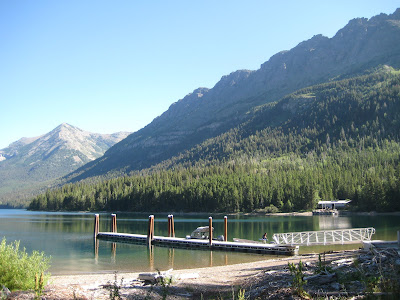
We caught a tour boat back down to the southern end of the lake. From there, we struck off to the west towards an amazing area called Boulder Pass.

On the way to our first night of camping, we cooled off in Thunderbird Pond. This lake is on the list, but I got to it many years ago. Still good for a nice dip.
The first evening we camped at Brown Pass Campground which is just above Bowman Lake.

It has been a little while since we had been up in these parts so both Jess and I were super excited.
There was a bountiful crop of Montana’s famous huckleberries. Its funny. Although they keep you going, they also seriously slow you down.
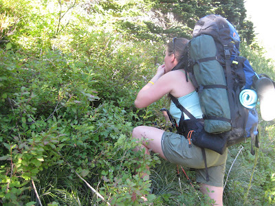
But, there is no better distraction. Bears have it figured out, folks.
So, the next morning we drug our tent a few miles up hill to a site called Hole in the Wall. From here we continued up hill, the trail meandering through the rock bands to Boulder Pass.

Would you believe that in the earlier parts of the 1900’s this whole picture would have been filled with Boulder Glacier and the trail had to lead up on the moraine in the right hand side of the picture.

Lots of things have changed around these parts since then.

Its amazingly open up on top of Boulder Pass. It is so newly melted out that there is no vegitation hardly at all. Just open views!!
Just over the pass we had to go off trail to the top of a ridge.
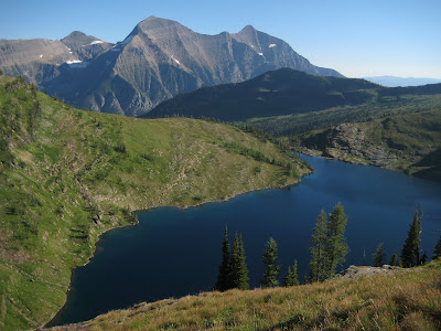
At the bottom was the long awaited Pocket Lake.
 We had to drop off of this ridge and work our way through some cliff bands, steep grass and flower filled slopes to get to the lake.
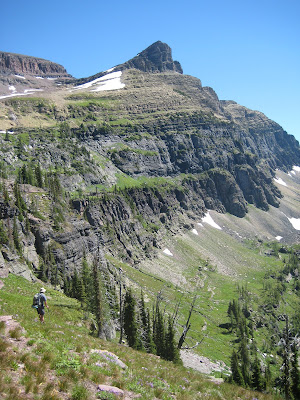
I don’t have any pictures of our way through the cliff bands. That is probably because I did not like it.
Funny thing about never being somewhere before. You almost always pick the less than perfect route.
Sometimes, you end up finding yourself with your heart racing as you hold onto a tree limb and try to scoot yourself down a wet rock band covered in moss. Just sayin’….Sometimes that happens…
Jess kept her cool and pulled me through. You’re the best!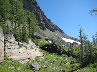 We made our way along a huge bench above the lake and then down broken cliff bands and grassy slopes down to the lake.
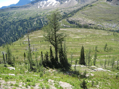
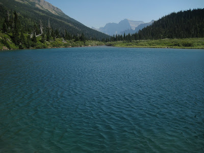
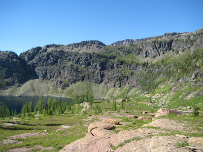
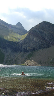
The lake was amazing. Somehow we scored three spectacular days of sunshine and calm weather. This would have been impossible if the storms moved in on us. This is one of the highest elevation lakes in the whole park.
Sometimes, you end up finding yourself with your heart racing as you hold onto a tree limb and try to scoot yourself down a wet rock band covered in moss. Just sayin’….Sometimes that happens…
Jess kept her cool and pulled me through. You’re the best!
We made our way along a huge bench above the lake and then down broken cliff bands and grassy slopes down to the lake.The lake was amazing. Somehow we scored three spectacular days of sunshine and calm weather.
This would have been impossible if the storms moved in on us. This is one of the highest elevation lakes in the whole park. So, I’d like to give a little shot out to the weather….
Lets give it up for the weather!!
Thanks everyone.
We still had to get out of this enormous “pocket” though. So since we were losing daylight we had to head out and climb back up to the pass.
Lets give it up for the weather!!
Thanks everyone.
We still had to get out of this enormous “pocket” though. So since we were losing daylight we had to head out and climb back up to the pass.
Thankfully, there was a much more pleasant way back through the cliffs. Its always upon return that you figure this stuff out. We had to make our way back along the shelf to the grassy ramp in the top middle of the picture.
We knew it was “the way in” when we saw that there was a nice animal path up the ramp. Steep and slippery, but well more straight forward.

Once back up top, we bid Pocket Lake farewell and headed on. We still had miles to make.
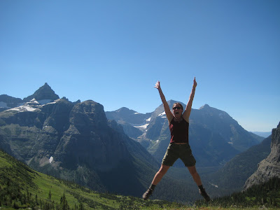
The view from atop Boulder Pass looking back towards Goat Haunt is about as good as it gets in the park. Wow!!

And with the last hour or so of sunlight for the day, we dropped back down to camp.
 The light softening the colors on the peaks we were surrounded by.
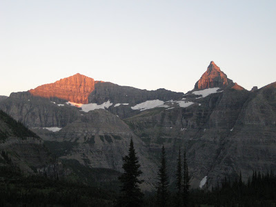
To finish the story, we made a late morning of it the next day. Felt like we earned a bit of sleeping in.
Good bye Boulder Pass. Good bye, Bowman Lake. Good bye, Goat Haunt.

I would like to point out to anyone reading this blog for the first time, that I have many past adventures to read about. So, continue sifting through the blog. Check out all of the other parts of the website too. www.firstgiving.com/glacierlakejumps
Anyone that has searched out the Waterton Glacier Lake Jumping Projects website, Welcome!!
I’ve been trying to harness this project to raise awareness for childhood cancer and to raise money for Camp Mak A Dream. I have been working on the project for seven years now.
So, thanks for popping by.

If you donate,….well your awesome.
If you check out the site and enjoy yourself enough to tell others then, you are Awesome too.
I have 34 lakes left after the six I’ve done this summer so far. I’ll keep plugging if you keep reading and following along.
Till then, I bid you farewell.
To Life,
Marc Ankenbauer
 We were able to keep tradition going once again with an awesome day in late August.
 After it we walked the outlet creek to the middle lake.
 This would have been a brutal one if it were nasty weather. Five lakes would get terribly chilly going at it in the rain.


 It did work though..


 It was right above the cliffs that drain the hanging basin. They drop off into Linham Falls.


 Somewhere through the evolutionary process of most animals,. they found out that “four legs good, two legs bad” is a valuable thing to keep in mind.
 We got out about 30 minutes after dark. Never great, but it is so much better when it’s dark and your on trail. Dark when your off trail is "No Bueno"!!!

 For anyone who knows about this delicacy, you understand how happy I was to have a communal chili feed in the middle of nowwhere.
 We said hello to the obelisk that marks the border and we headed west three and a half miles till we saw an entrance to a heavily wooded side valley that no one I have ever met has gone up.
  I’m sure its happened, but boy oh boy... would it be few and far between.
 Then into the guts we go.
 That always ends and gives way to a thick tree filled mess.


 Shortly after crossing it, we finally came to the first of our objectives.


 We were essentially going from one main valley to the next, but over, under and through the middle of nowhere.


 No jumping pics.
 Man that thing is nice.


